
Google presents a new pilot project
Chrome Experiments - is a great exhibition of interactive online technology projects. It allows for a second look to the future, in which the current demo version can become commonplace and really find practical application in everyday life. Google Experiments are not always useful from a practical point of view, but they regularly attract fans of new technologies. Most of the projects at least arouses curiosity and desire to try everything on their own. Last experiment on Google Chrome Experiments site called Land Lines and demonstrates the ability to identify visual input and its connection with the images from the satellite.
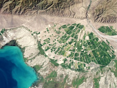
In other words, you draw anything in a browser on a smartphone or on your computer, and then Land Lines combines drawing with lines and strokes, which are in the basis of satellite images. This may be winding riverbed, or snow-capped peaks of the mountain range, or just turn at the crossroads.
In other words, you draw anything in a browser on a smartphone or on your computer, and then Land Lines combines drawing with lines and strokes, which are in the basis of satellite images. This may be winding riverbed, or snow-capped peaks of the mountain range, or just turn at the crossroads.
To create this technology, Google has used machine learning. With thousands of parameters, the program finds a match to your images on Google Earth.
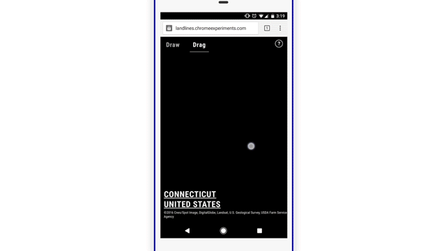
The other mode is called Drag. It uses similar mechanics analysis to combine your images with Google Earth images. However, in this mode, the Land Lines collects image frames from the satellite and connects them together, thus obtaining a continuous line consisting of highways, rivers, coastlines and so on. When you move your finger across the screen appears the line that follows it. This track will be instantly filled with new frames, repeating the shape of your line.
Land Lines is a rather interesting visual experience. Proven technologies alone can follow this link.